NASA Says 2026 El Niño Is Tracking Like 1997 and May Grow Even Bigger
Satellite sea-height maps show a Pacific heat buildup resembling the record 1997-98 event, and NOAA gives an 83% chance of strong to very strong conditions by early 2027.
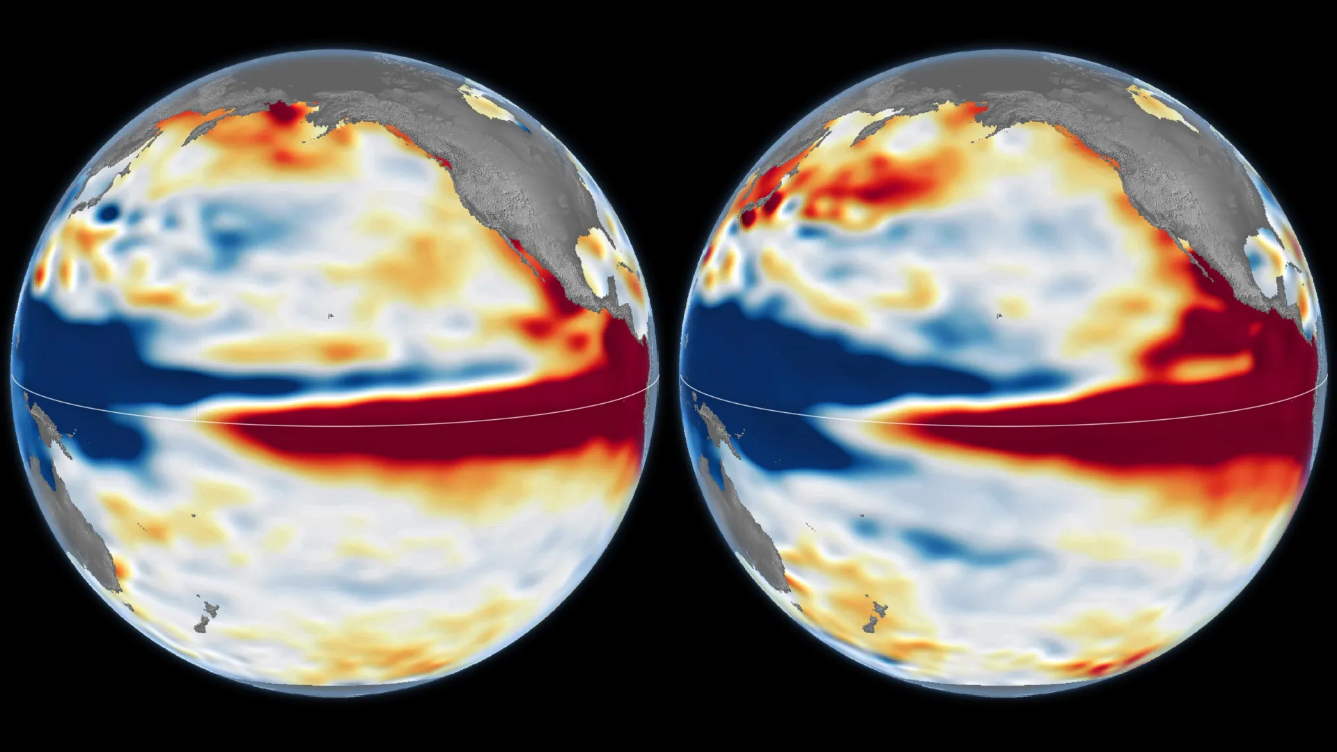
NASA scientists say the rapidly strengthening 2026 El Niño looks a lot like the record 1997-98 event and could end up larger, a comparison drawn from three decades of satellite measurements of the Pacific Ocean's surface height.
The agency's Earth Observatory compared sea-surface height maps from October 13, 1997, captured by the TOPEX/Poseidon satellite, and October 12, 2026, from the Sentinel-6 Michael Freilich satellite. It also used an October 12, 2015, map from Jason-2 to contrast the 2015-16 event. Warm water expands, so higher sea levels in the central and eastern equatorial Pacific signal a heat buildup. The comparison draws on a 35-year record from successive, nearly identical satellite missions.
Both 1997 and 2026 show low sea levels in the west, high levels in the east, and warm water reaching the South American coast. In 2015-16, warm water did not extend as strongly toward South America. This year's event intensified much more abruptly than the one in 1997-98.
Josh Willis, project scientist for sea level missions at NASA's Jet Propulsion Laboratory, said the search for a "typical" El Niño is "very elusive." About 2026, he said: "this one is on track to be even bigger." He cautioned that "there's always a bit of a dice roll here," and that the 1997 comparison is "just our best guess at the moment."
NOAA's October 8 outlook put the chance of strong to very strong El Niño conditions in January through March 2027 at 83%. El Niño typically recurs every two to seven years. The strong events of 1997-98 and 2015-16 brought fires in Indonesia and the Amazon, drought and crop failures in southern Africa, and flooding in Southern California.
The impacts differed between those two events. In 2015-16, rainfall concentrated over Central America and the southeastern United States, and Mexico saw significant flooding. The 1997-98 event delivered substantial rain to California and parts of the southern U.S. That difference is one reason NASA warns that a resemblance in the ocean does not guarantee a copy of the weather.
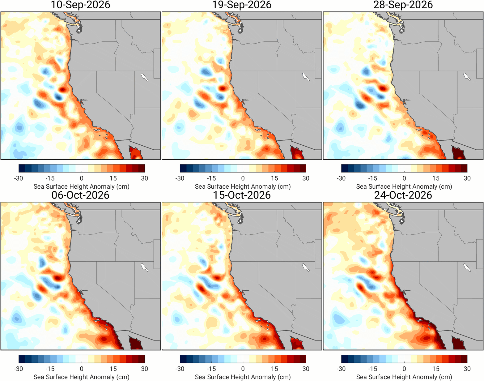
The effects of El Niño become harder to predict farther from the tropical Pacific, so heavy rain and flooding this winter are possible but uncertain. Forecasters have already warned of a warmer, wetter winter across much of the United States, and sea levels along the West Coast have been rising as a Kelvin wave from the event moves toward shore.
For anyone planning around winter weather, from farmers to emergency managers, the satellite picture offers an early warning without a precise forecast. It shows that the Pacific is warming in a pattern that, once before, preceded one of the most damaging weather years on record.