Hurricane Polo Hits Category 5 Off Mexico, Among the Strongest Pacific Storms Ever
Polo's winds peaked at 175 mph after what forecasters called a 'truly remarkable' burst of strengthening. It is expected to skirt the coast of Guerrero and Michoacán rather than make landfall.
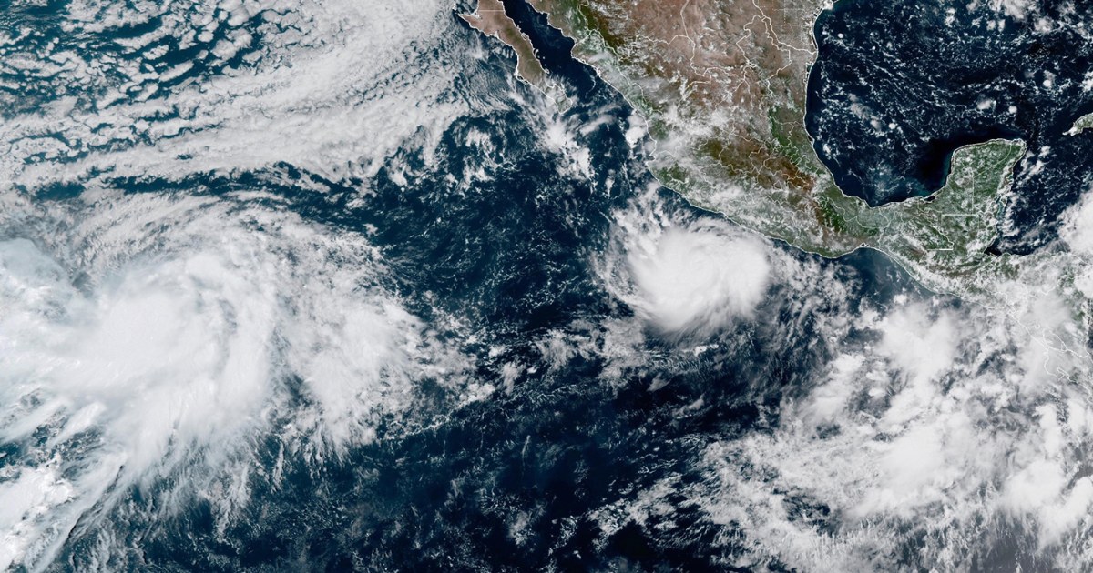
MEXICO CITY — Hurricane Polo has become one of the most powerful cyclones the eastern Pacific has produced in decades, reaching Category 5 strength on Tuesday with maximum sustained winds of 175 mph as it churned off Mexico's southwestern coast.
The U.S. National Hurricane Center called Polo "extremely dangerous" and wrote that it was "truly remarkable" how quickly the storm had strengthened in 24 hours. By Wednesday it had eased to Category 4, with winds of 150 mph, and sat about 165 miles south of Zihuatanejo and 320 miles southeast of Manzanillo, moving slowly north. Forecasters expect it to turn sharply northwest and then west-northwest over the next several days. "Fluctuations in intensity are expected, but Polo is expected to remain a very powerful major hurricane during the next few days," the center said.
"This is one of the strongest storms ever in the (Pacific) Basin," said Kristen Corbosiero, a professor of atmospheric science at the University at Albany. Hurricane center records show only a handful of storms in the region have reached comparable speeds in recent decades, most notably Hurricane Patricia, whose winds hit 215 mph in 2015. Polo is the third Category 5 hurricane of this Pacific season, after Genevieve and Lowell. Category 5 is the top of the Saffir-Simpson scale and means sustained winds above 157 mph.
Philip Klotzbach, a research scientist at Colorado State University, blamed El Niño, the periodic warming of the tropical Pacific. It has driven drought in Mexico and Central America and warmed the ocean where Pacific storms form. "There are all the ingredients that hurricanes need to get really strong really fast," he said. The same pattern has kept the Atlantic unusually quiet this year.
Mexican President Claudia Sheinbaum said experts do not expect Polo to make landfall. But hurricane-force winds reach 40 miles from its center and tropical storm-force winds reach 105 miles, and tropical storm conditions were expected along the coasts of Guerrero, Michoacán and Colima from Wednesday into Thursday. Forecasters called for 3 to 6 inches of rain in Guerrero and Michoacán, with lighter totals along the coasts of Oaxaca, Colima and Jalisco. Mexico's navy closed ports in Guerrero and Michoacán, and schools in several areas canceled classes on Tuesday.
The U.S. Embassy in Mexico told American citizens to stay off beaches and out of the water. "Even if the storm does not make direct landfall, heavy rain may produce life-threatening flooding and mudslides," it said. "Hazardous ocean conditions — intensified by storms — may result in deadly rip currents and rogue waves."
In Lázaro Cárdenas, a port city in Michoacán, waves were already pounding the shore as restaurant owner Concepción López Villegas tried to protect the business she has spent decades building. "We're worried and trying to protect our businesses," she said. "And of course, we're sad because it's our heritage, our legacy that from one moment to another could be destroyed." Farther out to sea, a second storm, Odalys, strengthened into a Category 1 hurricane on Wednesday about 1,295 miles off the southern tip of Baja California. It poses no threat to land.