Lidar Maps Reveal the Hidden Underground Rivers That Keep the Grand Canyon Alive
Scientists hauled laser scanners through more than 10 kilometers of remote caves to map the karst aquifer feeding Roaring Springs, finding that water can travel 20 kilometers underground in as little as a week.
Beneath the rust-colored cliffs of the Grand Canyon lies a hidden plumbing system of caves and fractured rock that quietly sustains one of the world's most iconic landscapes. Now scientists have mapped that underground network in unprecedented detail, hauling laser scanners through miles of remote passages to trace exactly how water moves through the canyon's depths.
The focus of the research is Roaring Springs, a group of springs on the canyon's North Rim fed by an intricate web of caves. The springs supply water to the millions of visitors who pass through Grand Canyon National Park each year and sustain the fragile ecosystems that depend on reliable flows. They emerge from the Redwall and Muav limestone formations and are part of what geologists call a karst aquifer — a system in which water carves channels through soluble rock, creating fast and often unpredictable underground pathways.
A team from Northern Arizona University's School of Informatics, Computing, and Cyber Systems led the effort. Ph.D. student Blase LaSala, remote sensing professor Temuulen "Teki" Sankey, and collaborator Abraham E. Springer of the university's School of Earth and Sustainability set out to turn the canyon's dark, hard-to-reach caves into precise three-dimensional maps.
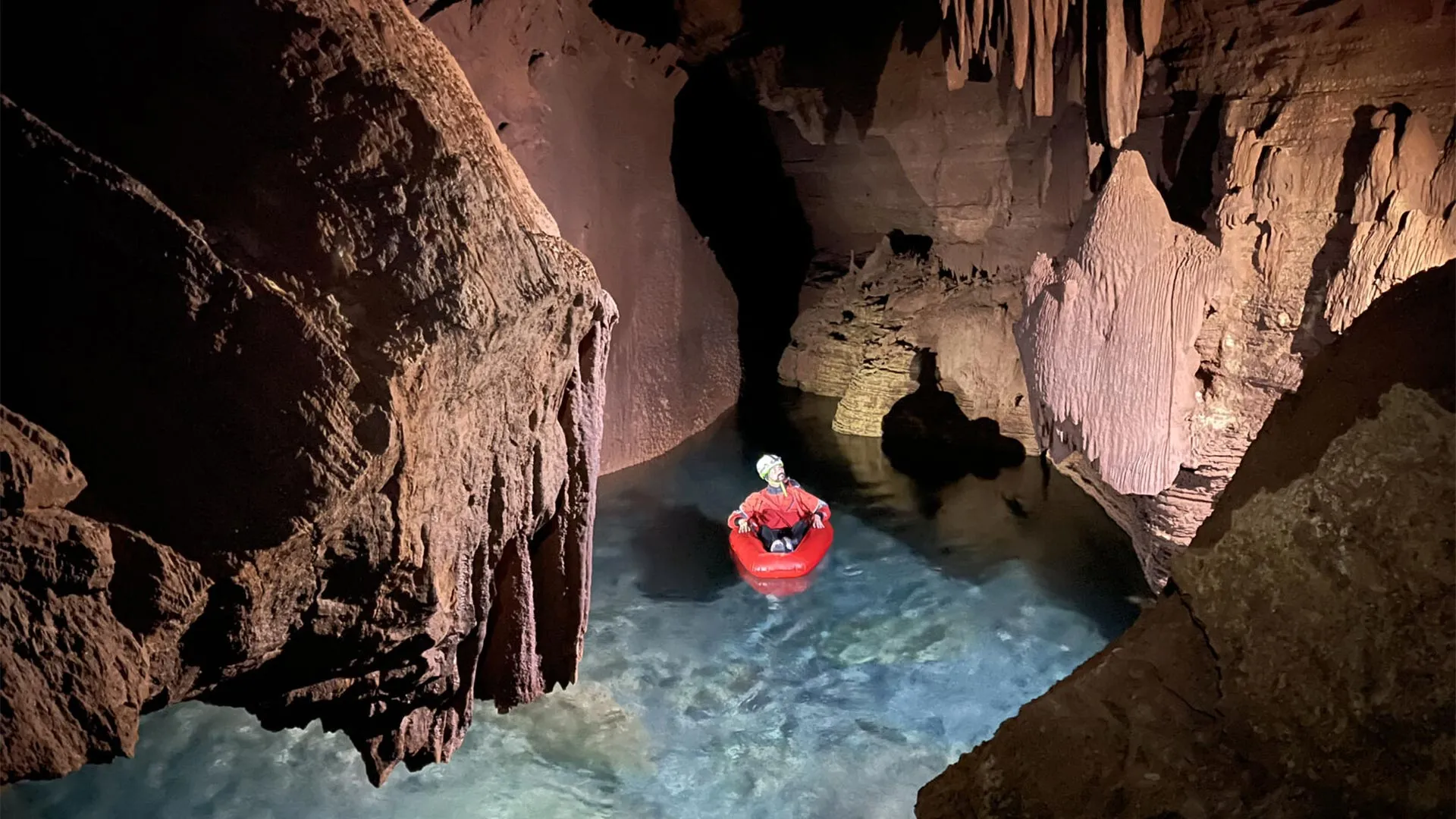
The fieldwork was grueling. Over 45 days, the researchers documented more than 10 kilometers of underground passages, using mobile lidar scanners that fire rapid laser pulses to build detailed digital models of the cave interiors. Reaching the cave entrances meant hiking to remote sites while carrying equipment weighing as much as 55 pounds, a physical ordeal that mirrored the difficulty of studying a system largely hidden from view.
The resulting maps revealed the cave structures and fracture patterns that channel water through the canyon's rock layers. To understand how quickly that water moves, the team also conducted dye-tracing experiments, releasing tracers and tracking where they emerged. The results were striking: water could travel roughly 20 kilometers in as little as one week, a pace that shows how rapidly contamination or drought effects could propagate through the system.
That speed is precisely why the work matters. Understanding the underground pathways helps managers protect the springs from pollution and anticipate how they will respond to a drying climate. The findings, published in the journal Scientific Reports, also reach far beyond Arizona: more than a billion people around the world rely on karst springs for their water, making the canyon a case study with global relevance.
For a landmark defined by what is visible — its towering walls and the Colorado River winding below — the research is a reminder that the Grand Canyon's survival also depends on an invisible network of water threading silently through the rock.
Originally reported by ScienceDaily.