7.4 Magnitude Earthquake Strikes Indonesia's Molucca Sea, Triggering Tsunami Warning
The region's strongest quake in six years killed one person, displaced nearly 2,000, and damaged hospitals and government buildings.
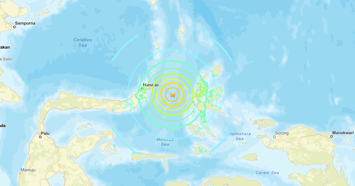
A powerful 7.4 magnitude earthquake struck the Molucca Sea off the coast of Indonesia's North Maluku province in the early morning hours of April 2, triggering a tsunami warning that was later lifted and causing significant damage across the archipelago. The U.S. Geological Survey measured the event at magnitude 7.4; Indonesia's Meteorology, Climatology, and Geophysics Agency put the figure slightly lower at 7.3. Either way, scientists described it as the strongest earthquake to strike the region in six years.
The quake struck at 6:48 a.m. local time along a thrust-fault system beneath the Molucca Sea, a seismically active body of water bounded by the Maluku and Sulawesi island groups. A tsunami warning was issued immediately and triggered rapid evacuations in coastal communities across North Maluku and North Sulawesi. A small tsunami was confirmed by monitoring stations before the warning was eventually lifted. The event generated at least 921 aftershocks in the days that followed, the largest of which registered magnitude 6.2 — itself a significant tremor that complicated rescue and assessment operations.
The human toll, while smaller than feared given the earthquake's magnitude, was nonetheless real. A 70-year-old woman was killed when a building collapsed in Manado, the capital of North Sulawesi province, and at least four people sustained injuries. A Siloam Hospital in Manado sustained serious structural damage, as did five government buildings and a hotel. The hardest-hit community was the Batang Dua Islands, a small island group in North Maluku where 1,966 people were displaced from their homes. Damage assessments there found 104 houses had completely collapsed, 85 were moderately damaged, and 79 sustained lighter damage — a severe blow for an isolated island community with limited resources for rapid rebuilding.
Indonesia sits on the Pacific "Ring of Fire," a horseshoe-shaped belt of intense seismic and volcanic activity encircling the Pacific Ocean where tectonic plates collide and subduct. The Molucca Sea sits at the intersection of multiple active plate boundaries, making the region one of the most earthquake-prone on Earth. The country experiences hundreds of significant earthquakes annually, and the 2004 Indian Ocean earthquake and tsunami — which originated off the coast of Sumatra and killed more than 230,000 people across 14 countries — remains a vivid reminder of the catastrophic potential of the region's geological instability.
Disaster response teams from Indonesia's National Disaster Management Authority deployed to the Batang Dua Islands within 48 hours of the earthquake to assess damage and begin coordinating relief. International relief agencies also monitored the situation, though the scale of the disaster — significant but not catastrophic — meant that the international response remained limited. As of April 7, the displaced population in Batang Dua remained in temporary shelter while officials worked to assess the structural safety of remaining buildings. The Indonesian government announced emergency reconstruction funding for affected communities, though the timeline for rebuilding in such a remote location remains uncertain.
Originally reported by CBS News.